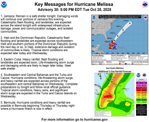
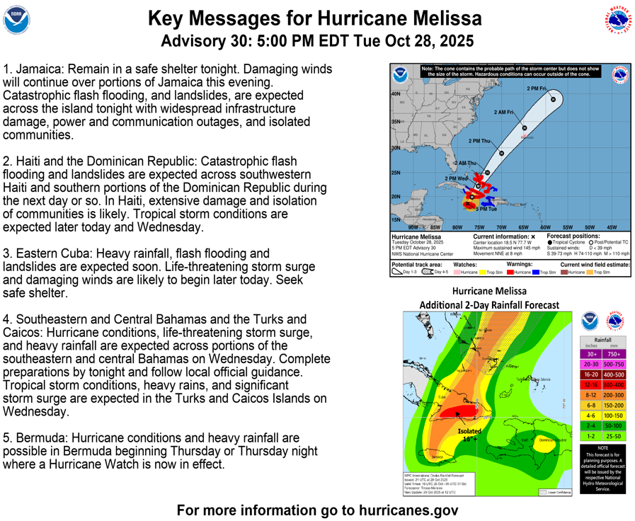
(Update at 5:00 p.m. on October 28, 2025). The US Hurricane Center – NOAA reports that Hurricane Melissa, a category 5 storm that reached Jamaica this morning, will continue throughout the evening. Parts of the island are currently without power. We recommend that all Italian nationals present in the area for various reasons remain in their shelters.
While Melissa’s eye is approaching the southwestern coast of Jamaica, NOAA recommends to stay in your shelter. THIS IS AN EXTREMELY DANGEROUS AND LIFE-THREATENING SITUATION! Do not leave your shelter as the eye passes over, as winds will quickly, and rapidly increase on the other side of the eye.
Residents should remain in place through the passage of these life-threatening conditions. To protect yourself from wind, the best thing you can do is put as many walls as possible between you and the outside. An interior room without windows, ideally one where you can also avoid falling trees, is the safest place you can be in a building. You can cover yourself with a mattress and wear a helmet for added protection.
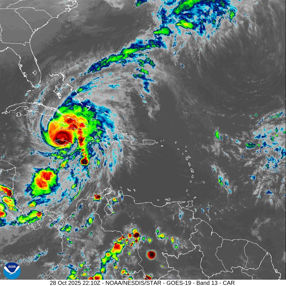
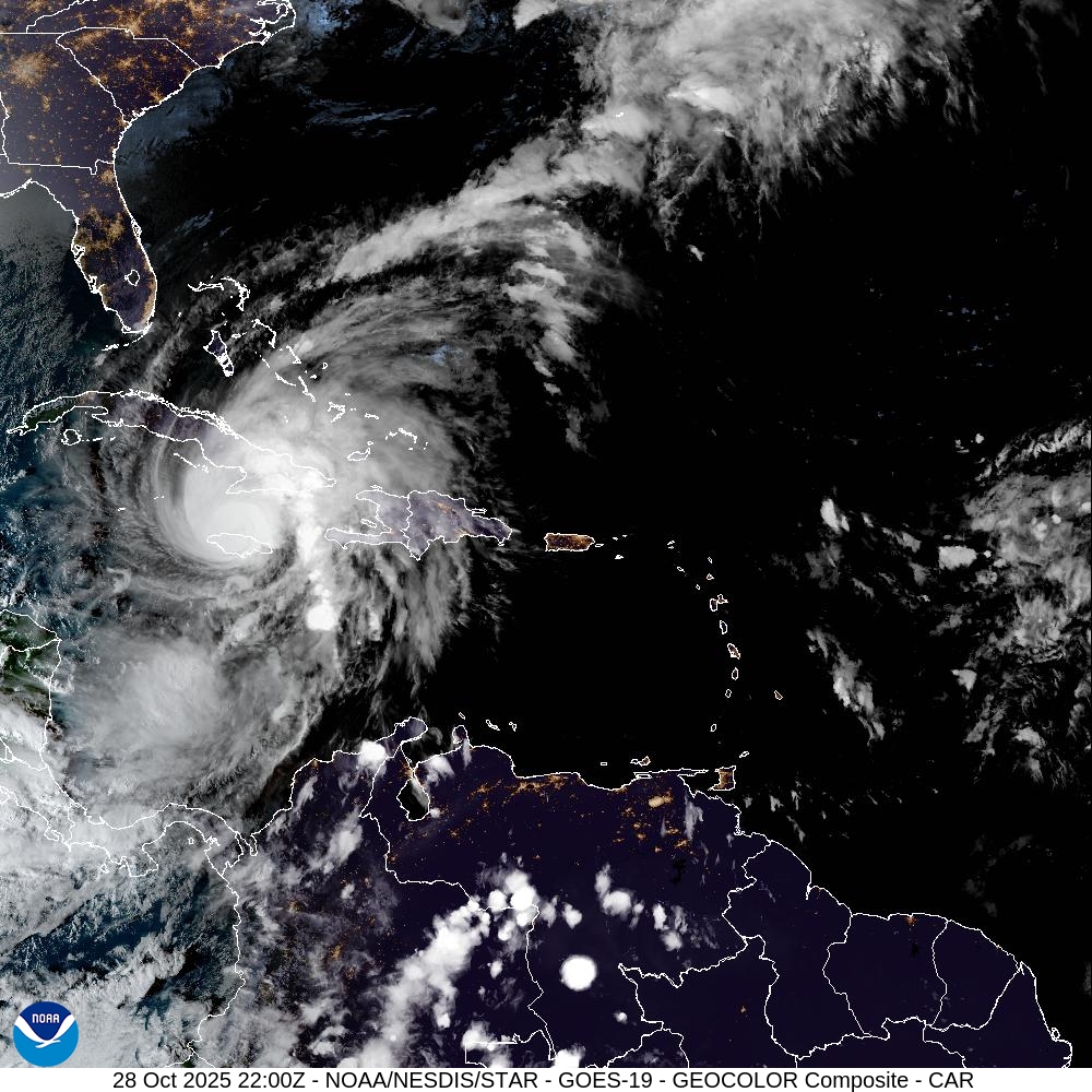
(Update 27/10/2025). The U.S. Center for Hurricanes – NOAA has reported that hurricane “Melissa” of category 5 on the Saffir-Simpson hurricane wind scale that is affecting the central Caribbean Sea area is expected to reach the coast of Jamaica today, where local authorities have issued a weather alert. As of 8 a.m. this morning, the hurricane was positioned 220 km southwest of Kingston, Jamaica, with maximum winds of 260 km/h.
According to the latest NOAA bulletin, Melissa is moving westward at about 3 mph (6 km/h). A slow turn to the northwest and north is expected today and tonight, followed by an ‘acceleration to the northeast starting Tuesday and continuing at least through Thursday. On the projected trajectory, Melissa’s center is expected to move near or over Jamaica tonight and Tuesday, cross the southeastern part of Cuba Tuesday night and the southeastern part of the Bahamas Wednesday. Melissa is expected to reach Jamaica and southeastern Cuba as a powerful major hurricane and will maintain its strength even as it crosses the southeastern Bahamas.
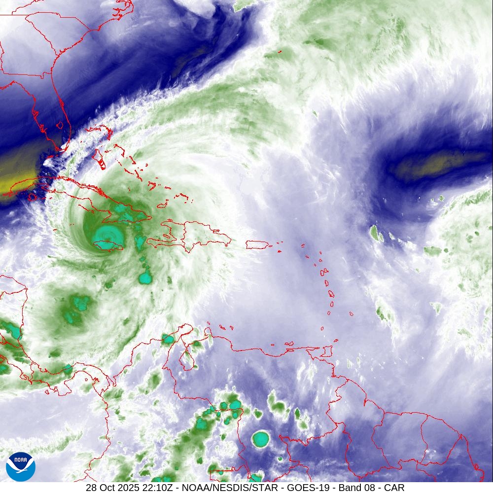
Hurricane force winds extend up to 30 miles (45 km) from the center and tropical storm force winds extend up to 195 miles (315 km).
Tropical storm conditions are occurring in Jamaica and destructive hurricane conditions are expected to begin tonight or early Tuesday morning. Tropical storm and hurricane conditions are possible in the southeastern and central Bahamas, as well as the Turks and Caicos Islands, Wednesday.
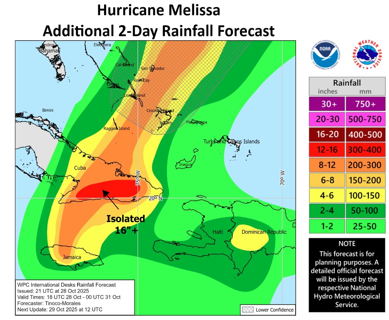
Melissa is expected to bring rainfall of 15 to 30 inches to parts of Jamaica and additional rainfall of 8 to 16 inches to southern Hispaniola through Wednesday, with a local storm total maximum of 40 inches possible. Catastrophic flash flooding and numerous landslides are likely.
Over the southeastern Bahamas, total rainfall of 4 to 8 inches is expected Tuesday through Wednesday, resulting in flash flooding in some areas.
A potentially lethal storm surge is likely along the southern coast of Jamaica tonight and Tuesday. The maximum height of the storm tide could reach 9-13 feet above ground level near and east of the point where Melissa’s center will touch land. This storm tide will be accompanied by large and destructive waves. A storm surge is possible in the southeastern Bahamas and Turks and Caicos Islands on Wednesday.
Waves generated by Melissa are expected to affect parts of Hispaniola, Jamaica, eastern Cuba and the Cayman Islands over the next few days, and the Bahamas, Turks and Caicos Islands and Bermuda later this week. These waves could cause dangerous sea conditions and back currents.
Significant flooding is expected in both the coastal area of the island and inland areas, with possible landslides. Strong winds and heavy rainfall are expected to increase further on Friday and Saturday. The disturbance, which appears to be moving very slowly, is poised to remain over Jamaica for several days and could rapidly increase in intensity evolving into a hurricane between next Saturday and Sunday.
It is strongly recommended that you constantly consult NOAA and local weather bureaus’ bulletins and follow all safety instructions issued by the relevant local authorities. The Consulate General in Miami is keeping in close liaison with the Honorary Consulate of Italy in Kingston and with the offices of the European Union Delegation, monitoring the evolution of the situation. Please also keep up to date through our social media, on which we repost NOAA alerts, warnings and alerts, and download the Italian Ministry of Foreign Affairs’ Viaggiare Sicuri app (by activating its geolocation).
The Consulate General of Italy in Miami can be contacted for emergencies involving Italian citizens at the following number: (001) 305 -753 -0532.


")